|
|
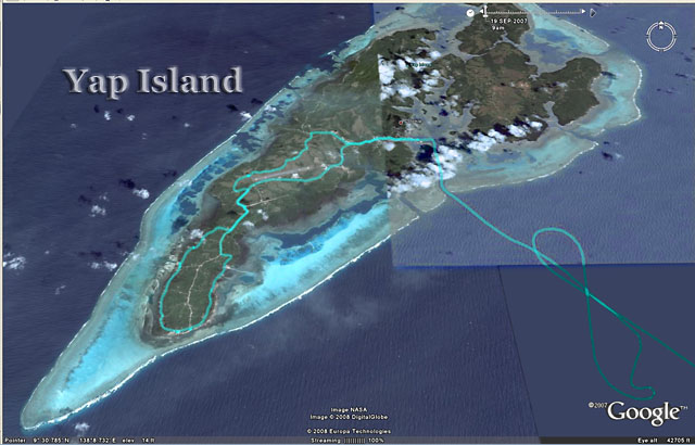
Google Earth Images with GPS Track
of a
Tour of Yap (turquoise) |
| After
a 4 night and 3 day sail from
Rabaul, New Guinea, the ship
arrived off Yap in the dark at 6:00 AM.
We sailed figure eights at 3 kts
outside the reef waiting for the
pilot. He apparently operated on
“Island Time”, and arrived at 8:00
AM. |
 |
|
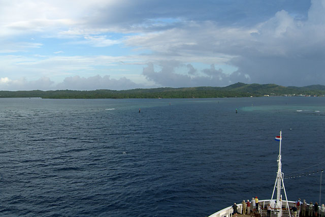
Approaching Yap and the Passage
Thru the Barrier Reef |
|
Navigating the narrow entrance thru the coral
reef was interesting.
Yap was scheduled to be a
tender port, but the Captain
arranged to tie up at the dock
instead.
|
|
 |
|

|
|
The Port at Colonia, Yap |
|
Colonia is the capitol of Yap.
The ship
was skillfully maneuvered in tight
navigable space between coral heads
to the dock without tugs. We heard
that the Statendam is the largest
ship to ever have docked here.
Yap is
one of The Federated States of
Micronesia. They gained
independence from the USA in
1986, but operate under a
Compact of Free Association with
the US, which is responsible for
its defense. The currency is the
US dollar. |
|
|
Yap Residence |
A couple ("D" &"K") who were table
mates at a couple of dinners
and the bridge (card game)
gurus on board, asked if I
would like to share a cab to
see the island, which I did.
We walked from the ship to
this neighborhood, where "K"
asked a resident to call
a cab for us. He
graciously did, using a
cell phone. After a
few minutes the cab picked
us up. The driver’s
name was Ray, a native
islander with excellent
English. He charged
$15/hr, which seemed like a
good deal. |
|
 |
|
|
|
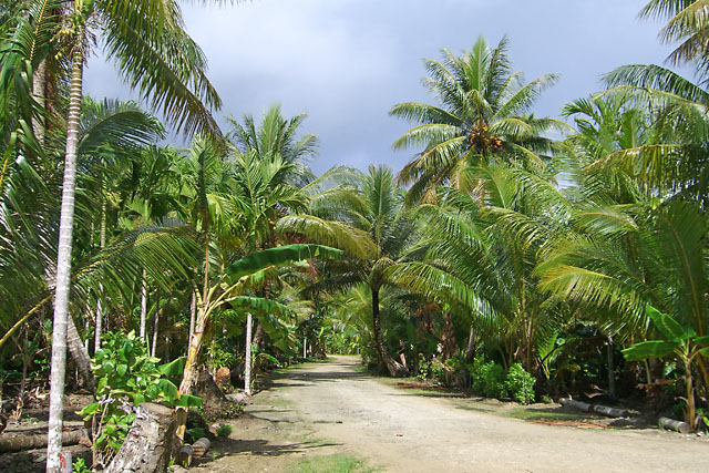
Yap Countryside |
Yap is all
privately owned and permission is
required to visit most places other
than public roads. The inhabitants
are Polynesian, with brown skin.
They grow most of their own food,
have chickens, and catch fish near
the reef. There are many dogs, as
was the case in Rabaul and
Guadalcanal.
Ray drove us to
his village where we saw stone
money, beaches, palm groves, taro
fields, schools, churches, etc.
The houses were widely separated.
There were many small fields used
for subsistence farming. There
were underground cables for phone
and cable TV service.
|
|
|
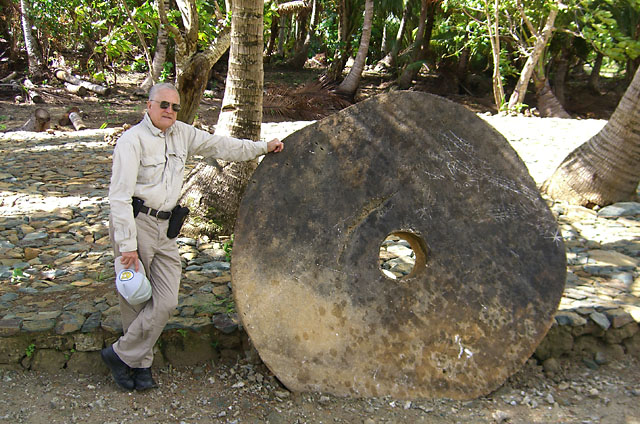
Stone Money |
|
Yap is
known for its
Stone Money. This on
of several in a row along a
rural road. Various sizes
were seen in many places. |
|
 |
|
|
|
Water Front |
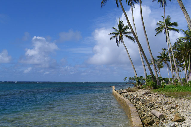
| Yap
has many beautiful waterfront areas.
Some have sandy beaches, others have
mangroves. This one has a wall to
protect against storm erosion. The
white line of breakers is at the
barrier coral reef. The lagoon
between land and the reef has calm,
clear turquoise colored shallow
water. |
|
|
Our Tour Taxi |
Yap roads have 15 and 25 mph
speed limits, which are
strictly observed.
Traffic drives on the right,
as in the US. Many of
cars, however, have the
steering wheels on the right
because they are second hand
vehicles from Japan.
|
|
 |
|
|
|
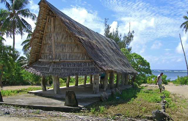
Village Meeting Place |
|
Villages
have governing councils which meet
in facilities such as the one in the
picture.
|
|
|
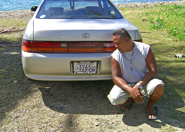
Ray, Our Driver and Guide |
The cab was a 1990's vintage
Toyota, similar the Camry.
Ray was chewing betel nuts,
which he told us all about.
When asked at what age
people started chewing, he
answered when they are able
to climb the trees to get
the nuts, which is about 12.
Ray received part of his
education on Saipan, where
he lived with an aunt. |
|
 |
|

|
|
New Grave |
|
Almost all
Yapese are Christian, divided about
50-50 between Catholics and
Protestants.
This is a new grave, elaborately
decorated as is the custom.
|
|
|
Yap Airport |
Looking south east from a
viewpoint on a ridge.
Yap is served by Continental
Airlines from Guam, Palau,
and Manila.
Yap was a Japanese base in
WW2. It was bypassed
by the Allies, but was
bombed many times by US
aircraft. We visited
an abandoned Japanese air
field where we wanted to see
some Zeros, but the thick
vegetation had taken over
and we didn't have machetes
to hack our way through.
|
|
 |
|
|
|
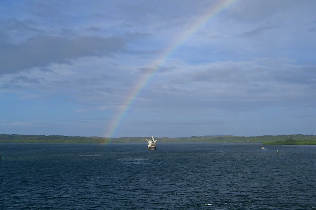
Departing Yap |
|
Our
consensus was it’s the prettiest
place so far.
The next port is Guam.
Tomorrow is a day at sea.
|
|
|


